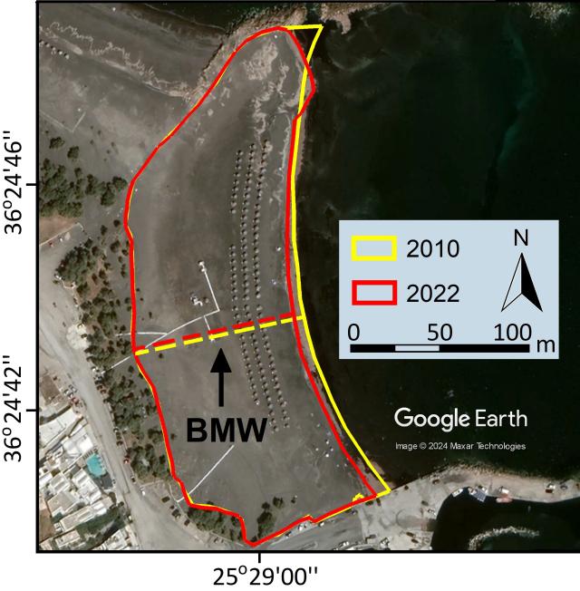
A beach inventory containing the physical and socio-economic/technical characteristics of all beaches of the 2 islands was created using primarily the satellite images and related optical information and tools available in the Google Earth Pro application. In order to facilitate consistency, a standard operating procedure for capturing beaches from the images was used. The subaerial (‘dry’) beaches were digitized as polygons, whereas the geo-spatial characteristics and other attributes of the database include beach location, dimensions (e.g. area and maximum beach width), sediment type and orientation, imagery acquisition dates, the presence of natural and artificial features (sand dunes, backshore cliffs, coastal defences and the density of backshore assets). In addition, other available relevant information (e.g. coastal topographic cross-sections, sediment grain size, socio-economic information) was also collated and stored in the data base. In order to assess historical changes, images from the Google Earth historical image tool were used. Metadata production from the digitized polygons was carried out in order to construct an interactive user-friendly web database using Google My Maps and Google Earth Web tools. Finally, the potential for parameterization and correlation of the geospatial characteristics was explored using advanced statistical tools.

