Within the framework of the project, a low cost, automated, high frequency beach monitoring system was used and further developed. The system consists of one or more video cameras suitably located, calibrated and geo-referenced that record time series of key parameters to beach morphodynamics, i.e. shoreline positions, wave breaking zones and run-ups. Following automated pre-processing at the field station PC, the imagery is transferred via an internet link to the lab for archiving, final processing and storage. The system can answer the Data Resolution Challenge with regard to the long-term, high frequency monitoring of the beaches, which form the most dynamic, critical and sensitive to climatic change coastal ecosystem. The system was installed at the pilot beaches of Kamari (Santorini) and Marmari (Kos).
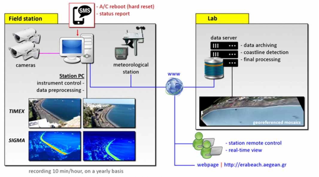
The field stations are completely autonomous, while it is possible to remotely manage its operating parameters and review the environmental conditions in real time. The optical system is calibrated (lens distortion, camera height above sea level, georeferenced points) so that primary videos and their products can be converted into georeferenced mosaics.
System Installation
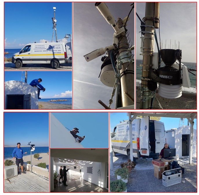
Three IP cameras (2 in Kamari and 1 in Marmari) were deployed at appropriate elevation to monitor the pilot beaches. The cameras provided video (3gp) of 10 min of every hour during sunlight, with a resolution of 1920×1080 and recording frequency of 5 Hz (i.e. frames per second). The cameras are stabilized, so that the optical field of view remains untouched during the lifetime of the station.
 System Set-up and Image Georectification
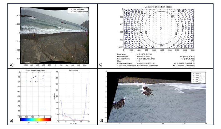
Despite the physical installation of the system. Additional actions were performed to set-up and georectify the optical products. Such actions include the correction of the geometry of the optical data due to lens distortion, as well as as the collection of Ground Control Points (GCPs), used to project the images/products to geographical coordinates from pixel points.
 Basic Products
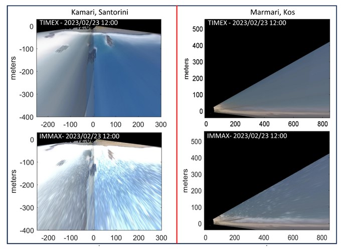
Despite the physical installation of the system. Additional actions were performed to set-up and georectify the optical products. Such actions include the correction of the geometry of the optical data due to lens distortion, as well as as the collection of Ground Control Points (GCPs), used to project the images/products to geographical coordinates from pixel points. Main coastal video monitoring products include the time-averaged coastal imagery-TIMEX and IMMAX images that represent the maximum brightness of the 10-minute recordings.
 Shoreline Detections
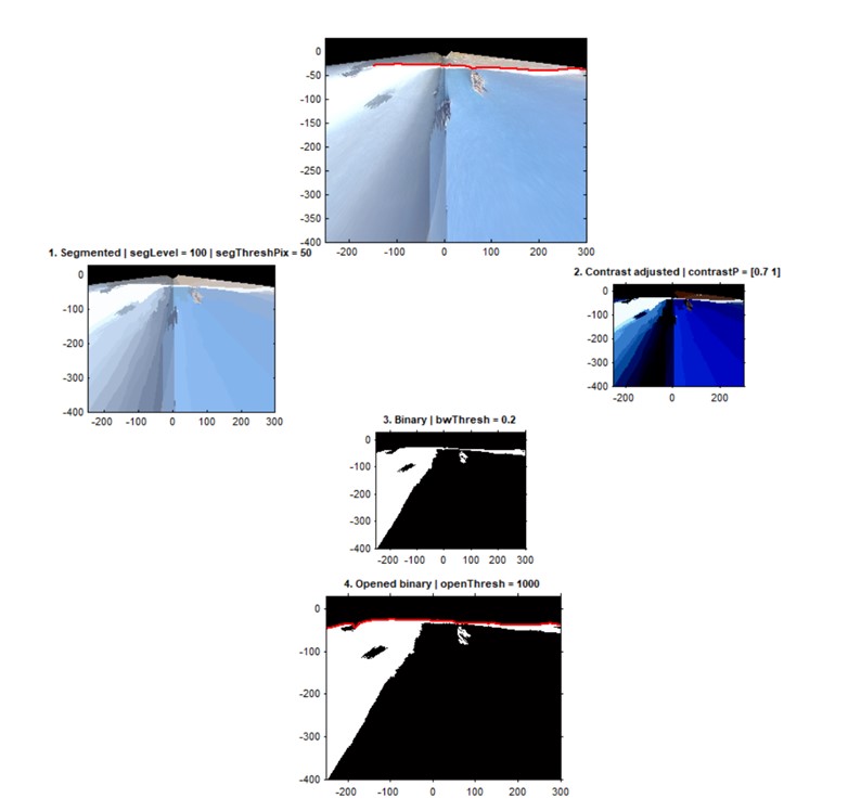
Shoreline detection on the optical data/images is achieved through automated algorithms based on objective and distinct criteria, developed from the project’s team. Detections are based on a local kernel algorithm that scans the IMMAX or TIMEX image superfast at the area of interest.
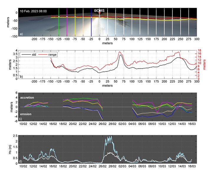
 Continuous operation of the optical system provides long-term and analytical time-series of the morphodynamic processed that take place in the study area.
