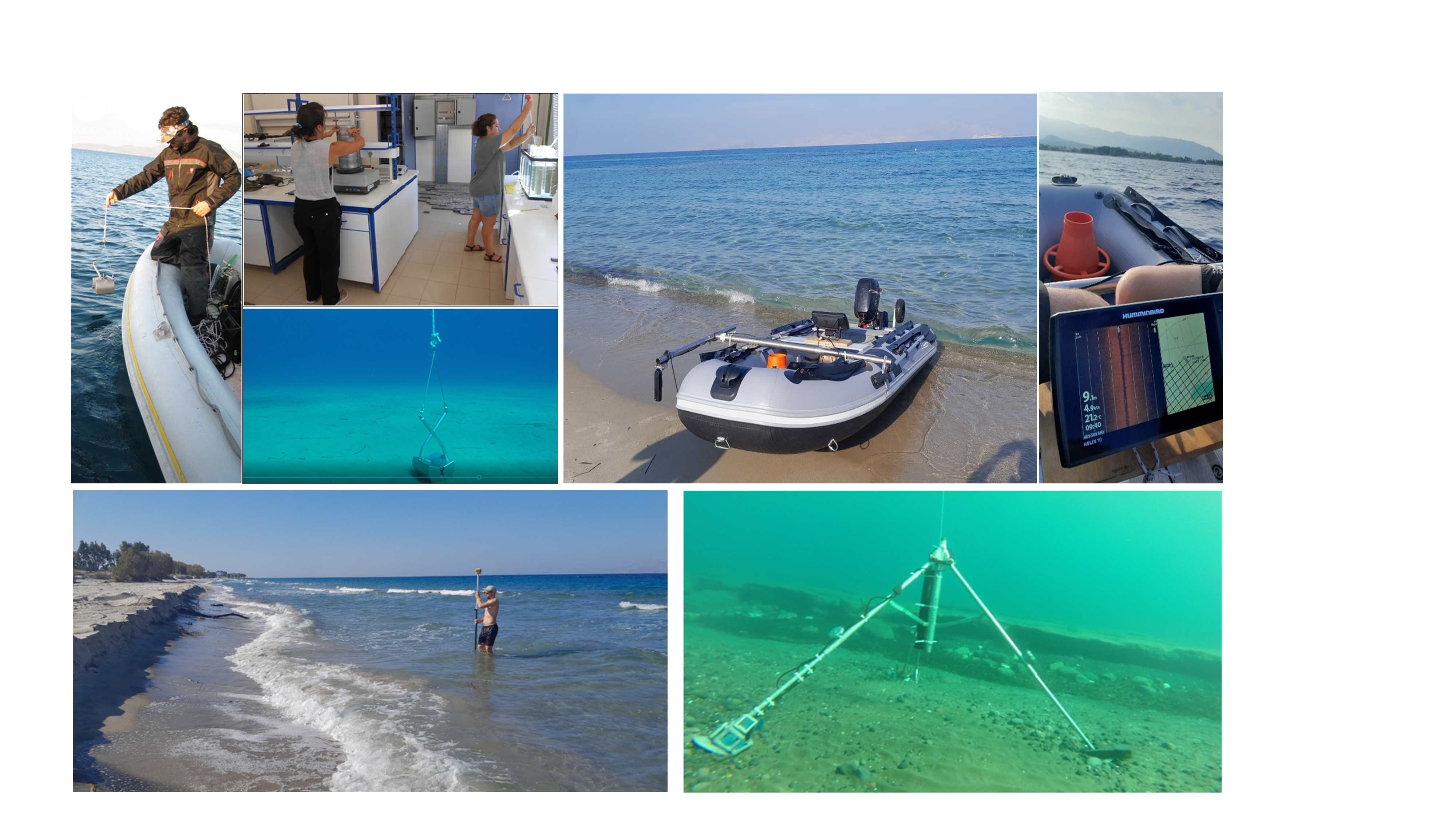
Beach morphology was recorded through dedicated topographic surveys (with the use of RTK-DGPS), while nearshore bathymetry was recorded through bathymetric and sedimentological surveys (with the use of side scan sonar). In addition, high frequency hydrodynamic records were collated with the use of pressure loggers and advanced wave-current meters (RBRs, ADV).
 Topo-bathymetric maps
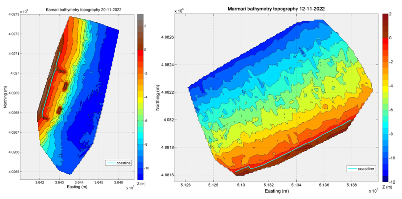
High resolution topo-bathymetric maps were produced, while emphasis was given in recording the position of the shoreline. In addition, the technical characteristics of each beach were recorded through dedicated surveys (sea walls, groynes and beakwaters).

Hydrodynamic records
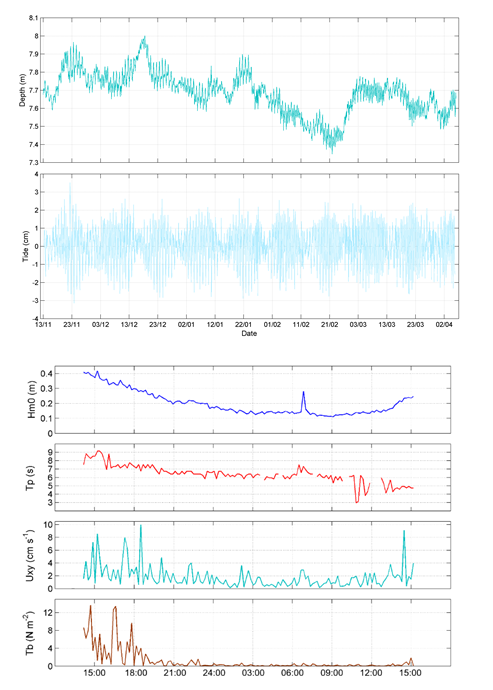
High resolution hydrodynamic records were retrieved for each beach for the energetic winter conditions (November till April). More specifically, sea level perturbations, wave heights and nearshore currents at specific points of interest were recorded.

